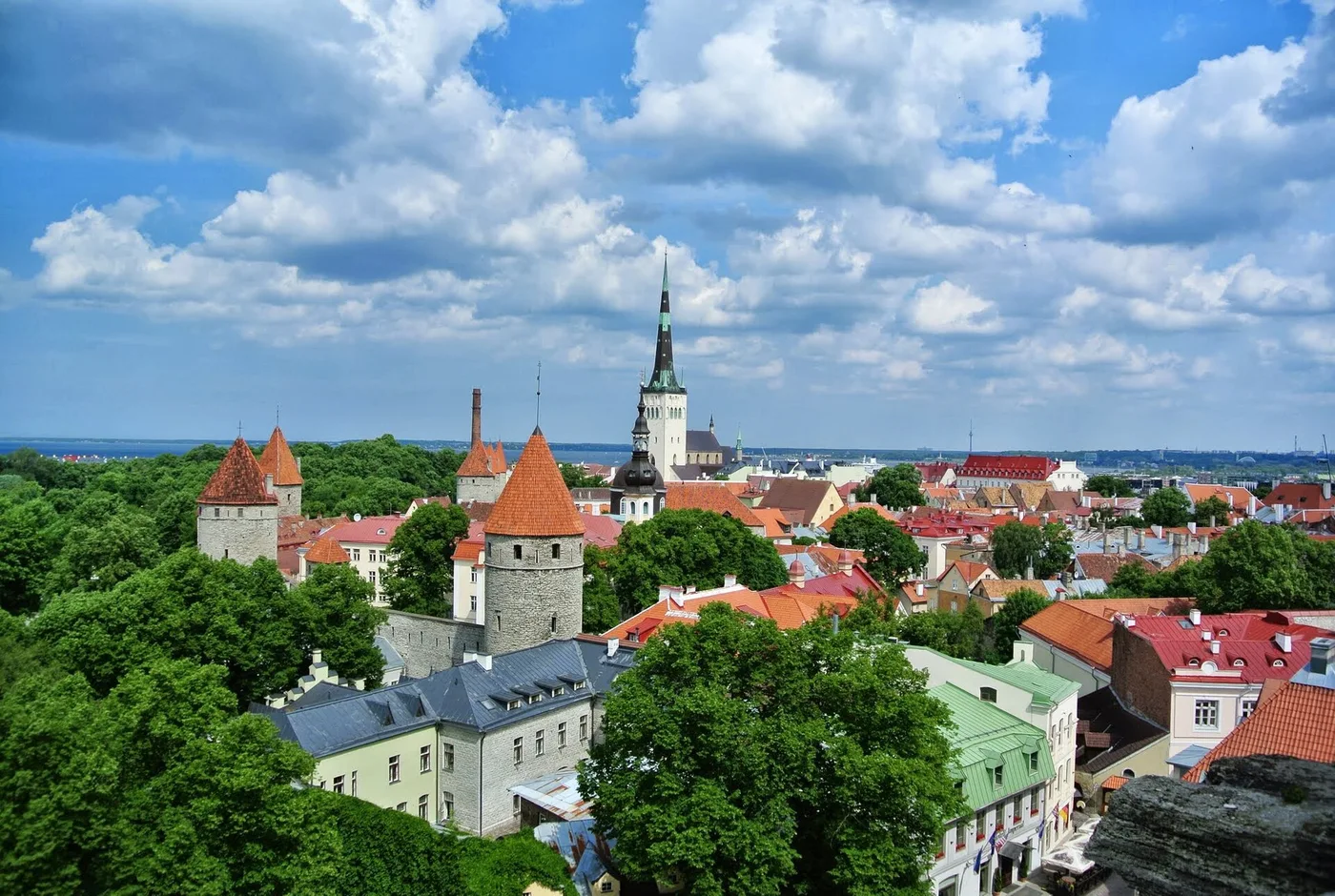
Tallinn: a thirteenth-century town plan that is still there
In Tallinn's old town the medieval street pattern is still remarkably easy to recognise. That does not mean every building has come down from the Middle Ages intact.
There are many European cities with an old core. Usually that means a few old streets, a square, a church, and around them centuries of rebuilding that erased the original pattern.
In Tallinn it is different. The Old Town has wholly preserved its structure of medieval and Hanseatic origin and represents an exceptionally intact thirteenth-century city plan. Since 1997 the area has been on the World Heritage List.
What that means exactly
The word that matters is structure, not buildings. Individual medieval houses exist all over Europe; what is rare is the pattern.
A town plan is the division of plots, the run of the streets, the placing of the gates and walls, and the relation between the trading quarter and the seat of government. That pattern is tougher than buildings, but it disappears as soon as a city is rebuilt wholesale or broken through by new axes.
That did not happen in Tallinn. You still walk through the division laid out in the thirteenth century.
The Hanseatic layout
That division is not accidental. Tallinn was a Hanseatic city, and Hanseatic cities were first of all trading places with a fixed logic.
There is a lower town where the merchants' houses stand, with narrow deep plots along the street and warehouse space behind and above. And there is an upper town on the hill, where the government and the nobility sat, with a wall of its own between them.
In Tallinn that distinction can still be walked: Toompea above, the lower town beneath, with gates and stairs between them. Where in other cities such a separation has merged into one whole, here it still stands.
Why it survived
The honest explanation is less heroic than the result.
Town plans usually disappear through prosperity. A city that grows rich pulls down and builds bigger. A city that goes through an industrial revolution lays railways and factories. A city that grows in the nineteenth century drives boulevards through its medieval core.
Tallinn did not go through those accelerations in that form. For a long time there was little reason to replace the old core, and the growth that did come was laid around it rather than through it.
What you see now is a historic urban structure that has remained recognisable, despite changes to individual buildings. That distinction makes a visit more interesting: you are looking not only at facades, but also at the course of the streets and the shape of the plots.
What that is worth
The irony is that what once meant backwardness for a city now makes it a destination. The same circumstances that let the medieval pattern stand meant little good for those living there, for centuries.
That is no reason to enjoy it less. It is the reason why the question of how you preserve such a thing when prosperity does arrive is sharper here than the map suggests.