
Pegel Kaub: what the Rhine's low water level does and does not mean
The level of the Rhine at Kaub in Germany is falling to a very low point once again. What the best-known gauge on the Middle Rhine measures, why the river runs low in late summer and how low it has been before.
On Wednesday 23 September 2026, the news agency ANP reported that the level of the Rhine at Kaub in Germany was once again falling to a very low point this week because of the ongoing drought. The official measurements show just how low. At 5 a.m. the gauge stood at 14 cm, and at 1 p.m. at 11 cm, according to the German waterways authority, the WSV, on its shipping portal ELWIS. For Sunday morning, 27 September, the Bundesanstalt für Gewässerkunde (BfG) expects a reading of about 6 cm. That is an estimate, not a firm forecast.
Kaub is a small town on the Rhine between Mainz and Koblenz. Yet many people know the name mainly from water-level reports. There is a reason for that.
A water-level gauge, not a depth gauge
Anyone reading '11 cm' might easily picture a river you could wade across. That is not how it works. Pegel is the German word for a water-level gauge. The figure shows how high the water stands above a fixed zero point, so it says nothing about how deep the river is. At Kaub that zero point lies at an elevation of 67.669 m, according to the WSV's key data.
What matters to skippers is the fairway: the part of the river that is kept at a set depth for shipping. For Kaub, the WSV works with a reference level of 77 cm. At that level the fairway is 1.90 m deep. If the level drops further, the room beneath the ships shrinks too. Working from those WSV key data, the fairway is still 1.13 m deep at a level of 0 cm. At Wednesday afternoon's 11 cm, and also at the estimate for Sunday morning, it is therefore still more than a metre.
So a low reading does not mean a dry riverbed, but a smaller margin. The lower the water, the shallower a vessel's permitted draught and the less cargo it can carry.
Why Kaub of all places
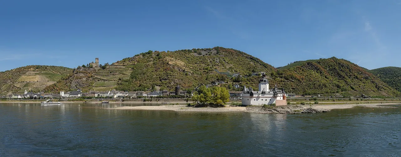
The gauge stands at Rhine kilometre 546.23, in the narrow Middle Rhine valley. Kaub lies on the stretch between St. Goar and Mainz. According to the German inland shipping association BDB, this stretch is a bottleneck for inland navigation, because the fairway there has been dredged less deeply than upstream and downstream. Ships have no way around it.
That is why inland shipping bound for ports upstream of Koblenz goes by the Kaub reading. Skippers use it to decide how much cargo to load, and carriers tie low-water surcharges laid down in their contracts to it.
Kaub also sits within protected heritage. Since 2002 the town has been part of the Upper Middle Rhine Valley UNESCO World Heritage Site, which according to the German Commission for UNESCO stretches for 65 river kilometres between Bingen, Rüdesheim and Koblenz. The commission describes the valley as one of Europe's most important transport routes for two millennia. The best-known narrows is the Loreley, where the river is only 130 m wide and, at 20 m, also at its deepest in the entire Middle Rhine valley, the commission writes.
This summer showed what low water means there. Many inland vessels could barely navigate the Middle Rhine any more, and there were fears that the Rhine would be split in two for freight shipping. Because each vessel carries less, more cargo capacity is needed, and transport costs rise disproportionately, according to the BfG.
Why the Rhine drops in late summer
The Rhine draws on two kinds of source. In the Alps it is fed by snow and glaciers. Further downstream, in Germany, the share of rainwater grows, the BfG explains. How high the water stands therefore depends on rain, temperature, snowmelt and glaciers. That makes late summer and autumn the usual season for low water.
Hydrometeorologist Jan Verkade of Deltares and Rijkswaterstaat told NOS, in the feature 'De machtige Rijn sijpelt naar zee' of 11 August 2026, that February had been wet, but that it then stayed exceptionally dry, so the discharge did not rise in spring as it normally does.
For a long time, 25 cm, measured on 22 October 2018, stood as the lowest known reading at Kaub. That figure still appears in the WSV's key data. In August 2026 the water fell below it. At the beginning of August, the news agency dpa, citing the German waterways office for the Rhine, had already reported a reading of 17 cm. In the week from 14 to 20 August, even the daily average at Kaub was below the old lowest reading, the BfG writes. The WSV has not yet set a new official lowest reading. The raw measurement data must first be checked, and that only happens once the low-water situation has clearly improved, the BfG explains.
Rain at the end of August lifted the water by a few decimetres, but it has been falling again since early September, the BfG reports. In its low-water report of 17 September 2026, it does not expect any noticeable, lasting improvement in the coming weeks either.

Morning mist in the Upper Middle Rhine Valley near Rheindiebach, a few kilometres upstream of Kaub, 30 October 2022. On the left the ruins of Fürstenberg Castle above the vineyards; bottom right the Rhine, with Lorchhausen on the opposite bank. · abbilder, CC BY 4.0